Big-4 Rail Trail Guide
© ZionsvilleIndiana.com
Big-4 Rail Trail
The Big-4 Rail Trail is Zionsville’s main paved trail corridor, beginning at the Zionsville Road trailhead on the southeast side of town and continuing northwest to the Whitestown border. Along the way, it links parks, neighborhoods, a Village-area access point, and several rest areas.
The Zionsville section is about 5 miles long, with a wide paved surface for walking, running, biking, strollers, mobility devices, and leashed dogs. The trail also continues into Whitestown, creating a nearly 9-mile paved route for longer walks and rides.
Quick Facts
- Zionsville section length: About 5 miles
- Connected Zionsville-to-Whitestown route: Nearly 9 miles
- Surface: 12-ft-wide paved asphalt
- Uses: Walking, running, biking, strollers, mobility devices, leashed dogs, and Class 1 or Class 2 e-bikes
- Not allowed: Class 3 e-bikes, electric scooters, mini-bikes, one-wheels, gasoline-powered vehicles, and other prohibited motorized vehicles
Trail Safety Guidelines
The Rail Trail is shared by walkers, runners, cyclists, families with strollers, and people using mobility devices. Keep right, pass on the left, announce yourself before passing, and slow down near curves, crossings, bridges, and busy trailheads.
Town guidance allows Class 1 and Class 2 e-bikes on Zionsville trails. Class 3 e-bikes, electric scooters, mini-bikes, one-wheels, gasoline-powered vehicles, and other prohibited motorized vehicles are not allowed.
For the original town guidance, see the public Facebook post and related trail safety video.
Plan Your Route by Segment
This guide divides the Rail Trail through Zionsville into shorter sections, with approximate distances and parking near each end. Use the first table to choose a starting point, plan a turnaround, or compare shorter and longer sections before reading additional notes below.
Trail Sections, Distances, and Parking
| Section | Distance | Parking near south end | Parking near north end |
|---|---|---|---|
| Section 1: Zionsville Road to Town Hall | ~1.5 miles | Zionsville Road Trailhead lot | Town Hall lot |
| Section 2: Town Hall to Bloor Lane | ~0.4 mile | Town Hall lot | Jennings Field lot on Bloor Lane |
| Section 3: Bloor Lane to Mulberry Street | ~0.6 mile | Jennings Field lot on Bloor Lane | Mulberry Fields Park lot |
| Section 4: Mulberry Street to Heritage Trail Park | ~1.6 miles | Mulberry Fields Park lot | Heritage Trail Park lot |
| Section 5: Heritage Trail Park to Whitestown border | ~1.2 miles | Heritage Trail Park lot | None |
Trail Features by Section
Use this table for a quick look at trail details that change from section to section, including street crossings, restrooms and drinking water, bike repair stations, and tunnels. The section notes below point out where those features appear along the trail.
| Feature | Sec. 1 | Sec. 2 | Sec. 3 | Sec. 4 | Sec. 5 |
|---|---|---|---|---|---|
| Street crossing | Yes | No | No | No | Yes |
| Restrooms & drinking water | Yes | Yes | Nearby | Nearby | Yes |
| Bike repair station | Yes | Yes | No | No | No |
| Notable structure | Bridge, Overpass, Tunnel | Underpass | Underpass, Tunnel | Tunnel | No |
The detailed guide below follows the trail from the Zionsville Road Trailhead toward the Whitestown border in a general northwesterly direction. Each section includes a route description, parking and amenity notes, and mileage points for trail connections, crossings, landmarks, and rest areas.
1 of 5
Section 1: Zionsville Road to Town Hall
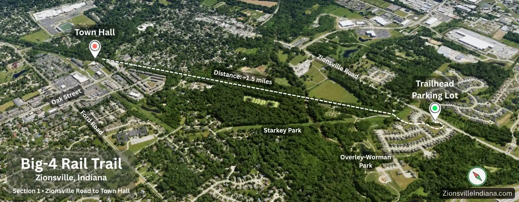
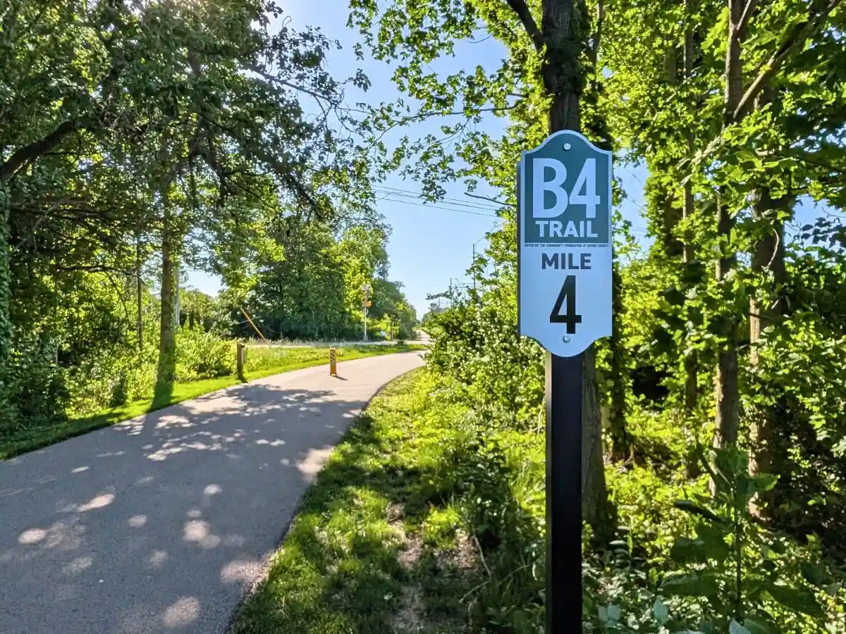
The trail begins at the Zionsville Road trailhead and follows the road past the tall metal sculpture and around a low hill. It curves right, with homes on the left, before reaching the Mile 0 post for the Rail Trail.
From there, the path crosses Lemberger Boulevard, a main entrance into the neighborhood around the south end of the trail. A marked crosswalk leads to the next section, where the trail climbs into the wooded portion that continues for much of the route to Town Hall. This is the main uphill climb in the segment and is most noticeable on a bike or with a stroller.
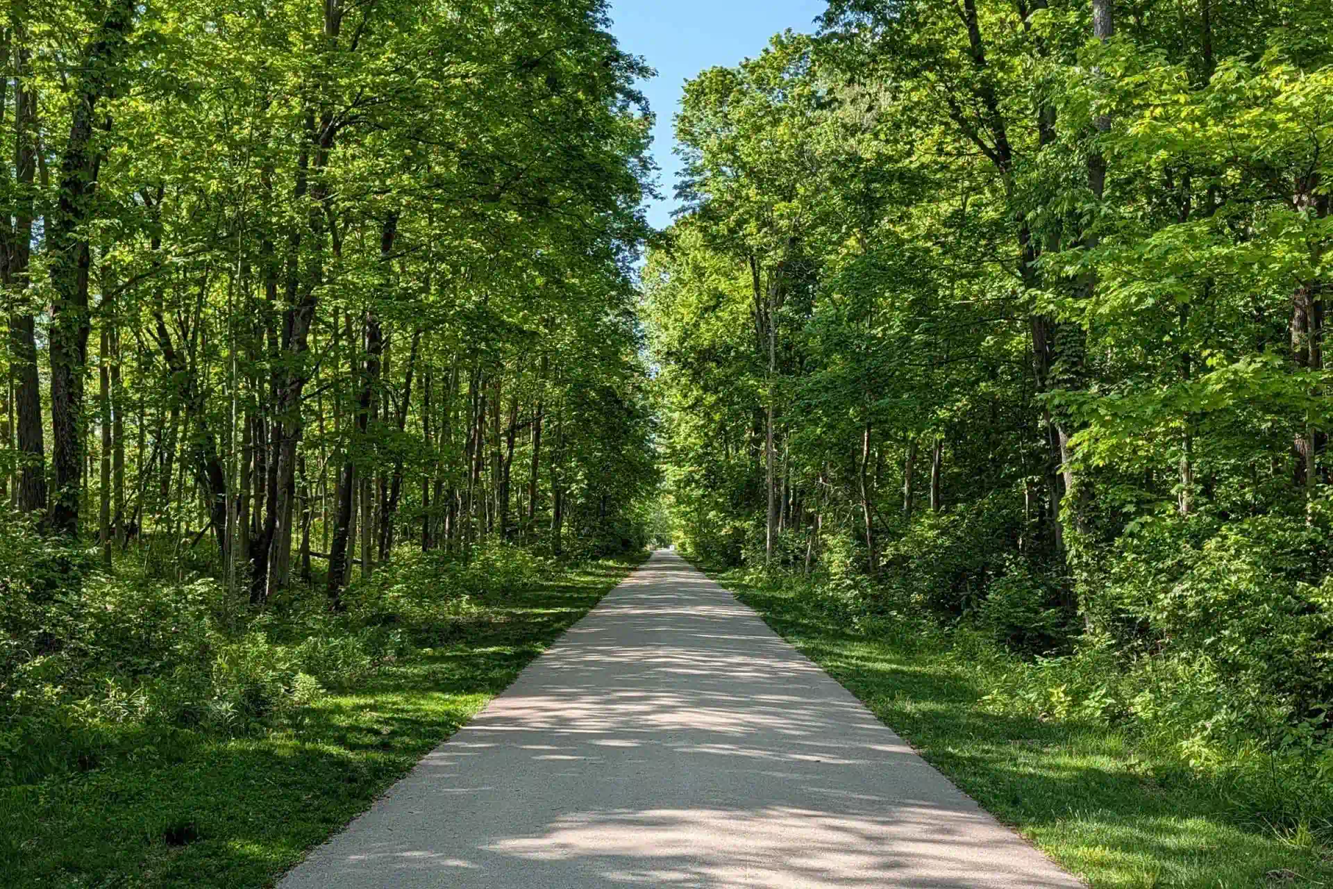
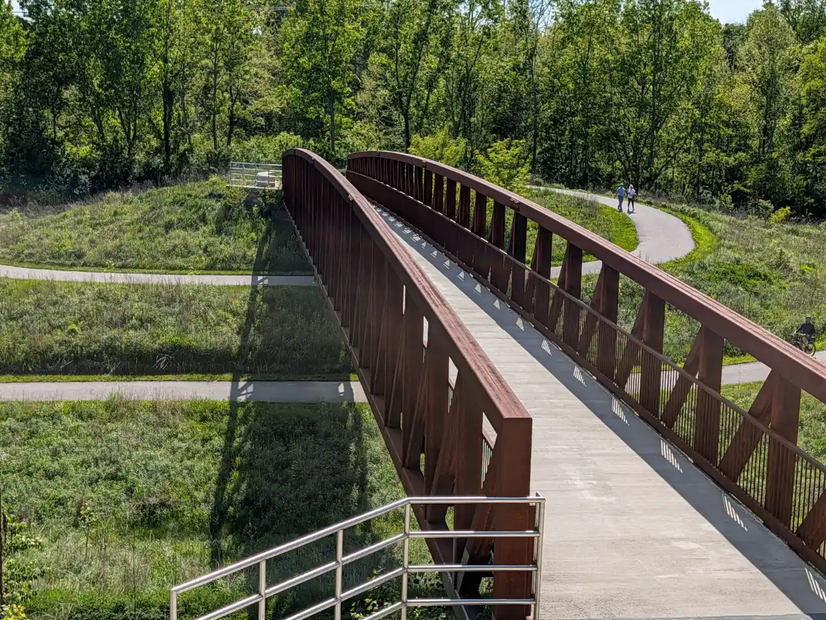
The Rail Trail follows a general northwesterly direction, passing through long tree-lined stretches for much of the route. Within the first half-mile, several side paths connect to Overley-Worman Park, including stairs, bridge access, and two bike-friendly paths: one reached from the northbound side of the trail and one from the southbound side.
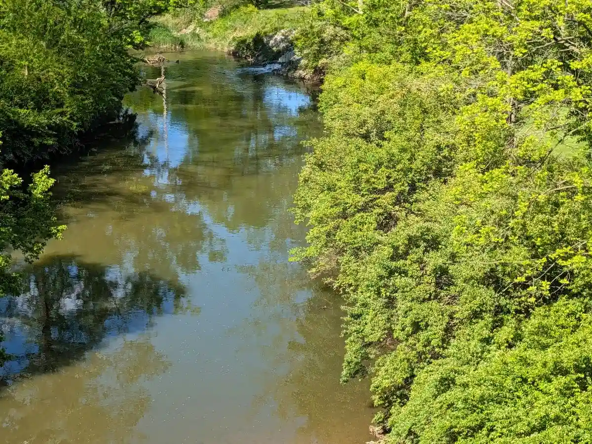
Just past the half-mile mark, the trail crosses Eagle Creek on a historic railroad bridge, also known as the Eagle Creek Bridge or One-Hundred-Foot Bridge. Built in 1919, the bridge once carried rail traffic for the Cleveland, Cincinnati, Chicago & St. Louis Railway, better known as the Big Four. Today, it offers the clearest creek views along the Zionsville section of the Rail Trail.
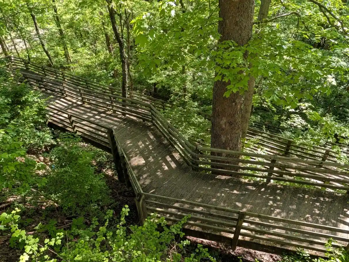
After the Eagle Creek bridge, the trail reaches the Starkey Park Trail 1 junction. SP1 leaves the Rail Trail here and descends by wooden boardwalk switchbacks into Starkey Park. A bike repair station and bike rack are located along the Rail Trail at this junction.
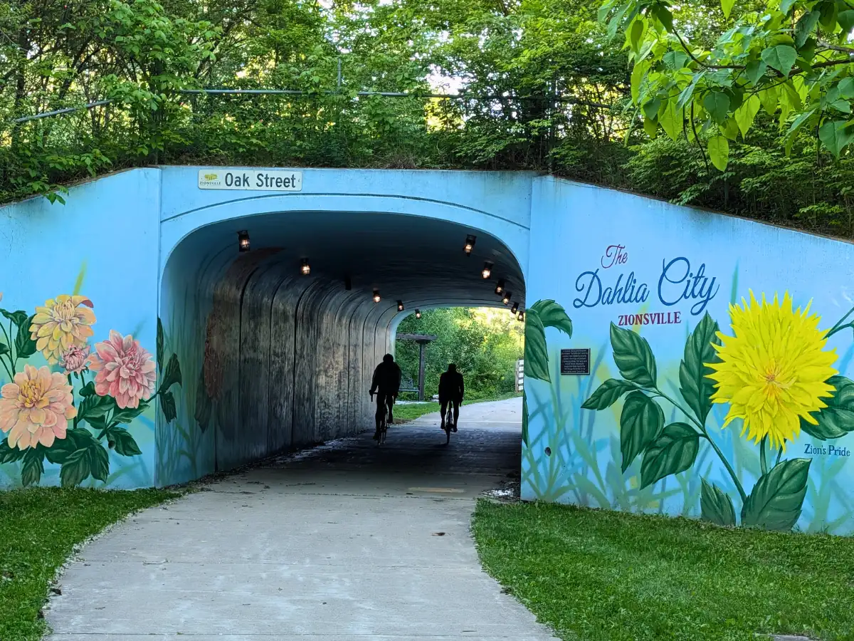
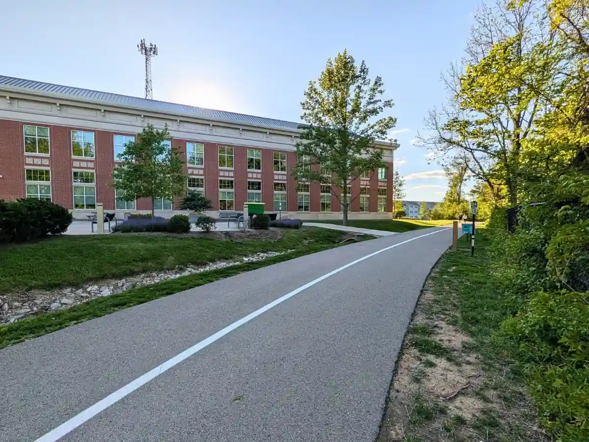
From there, the route continues to a Zionsville Train Depot historic landmark sign, marked by two benches along the trail. It then passes the Pine Street connection and Oak Street tunnel before reaching the Mile 1.5 post at Town Hall. The nearby rest area includes benches, a bike repair station, a little free library, and trash cans, with weekday restrooms and drinking fountains available inside Town Hall.
Section 1 at a Glance
| Detail | Information |
|---|---|
| Distance | ~1.5 miles |
| Parking | South end: Zionsville Road Trailhead lot North end: Town Hall lot |
| Street crossing | Lemberger Boulevard, a main entrance into the neighborhood |
| Restrooms | Zionsville Road Trailhead: restrooms with baby changing tables and a family restroom Town Hall: indoor restrooms available Monday–Friday, 8 AM–4 PM Starkey Avenue Trail Parking: portable restroom |
| Drinking water | Zionsville Road Trailhead: drinking fountain and bottle filler Town Hall: indoor drinking fountains and bottle filler available Monday–Friday, 8 AM–4 PM |
| Bike repair stations | Zionsville Road Trailhead Along the Rail Trail at the Starkey Park Trail 1 junction Town Hall rest area |
| Seating | Benches at the Zionsville Road Trailhead, along the trail, and at the Town Hall rest area |
| Dog waste stations | Located along the trail |
| S-Curve | S-curve with centerline stripe near Town Hall |
| Tunnel | Oak Street tunnel |
| Key points | Mile 0 post; Overley-Worman Park connections; Eagle Creek Bridge; Starkey Park Trail 1 junction; Zionsville Train Depot historic landmark sign; Oak Street tunnel; Mile 1.5 post |
Mileage and Trail Features
| Distance from Mile 0 post Distance from Town Hall | Trail feature / access point |
|---|---|
| 0.40 mi | Bicycle and pedestrian path to Overley-Worman Park bridge |
| 0.43 mi | Stairs to the Overley-Worman Park bridge |
| 0.49 mi | Path to Overley-Worman Park |
| 0.54 mi | Eagle Creek Bridge, also known as the One-Hundred-Foot Bridge |
| 0.55 mi | Starkey Park Trail 1 access; SP1 descends by wooden boardwalk switchbacks into Starkey Park |
| 1.09 mi | Zionsville Train Depot historic landmark sign and benches |
| 1.10 mi | Access path to the smaller trail parking lot along Starkey Avenue |
| 1.17 mi | Pine Street connection, just west of 9th Street; Main Street is about 0.5 mile east via Pine Street |
| 1.34 mi | Oak Street tunnel |
| 1.53 mi | Mile 1.5 post and Town Hall rest area; benches, bike repair station, little free library, trash cans, weekday restrooms, and drinking fountains |
| 0.00 mi | Mile 1.5 post and Town Hall rest area; benches, bike repair station, little free library, trash cans, weekday restrooms, and drinking fountains |
| 0.19 mi | Oak Street tunnel |
| 0.36 mi | Pine Street connection, just west of 9th Street; Main Street is about 0.5 mile east via Pine Street |
| 0.43 mi | Access path to the smaller trail parking lot along Starkey Avenue |
| 0.44 mi | Zionsville Train Depot historic landmark sign and benches |
| 0.98 mi | Starkey Park Trail 1 access; SP1 descends by wooden boardwalk switchbacks into Starkey Park |
| 0.99 mi | Eagle Creek Bridge, also known as the One-Hundred-Foot Bridge |
| 1.04 mi | Path to Overley-Worman Park |
| 1.10 mi | Stairs to the Overley-Worman Park bridge |
| 1.13 mi | Bicycle and pedestrian path to Overley-Worman Park bridge |
2 of 5
Section 2: Town Hall to Bloor Lane
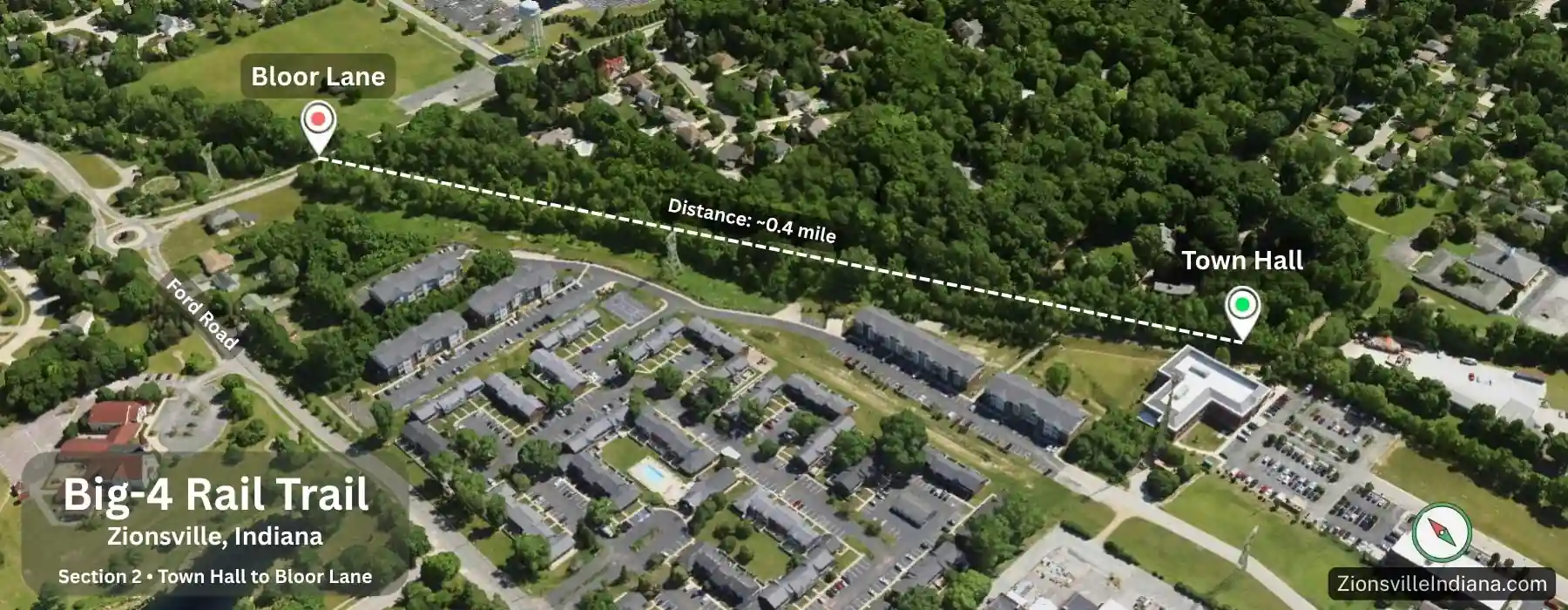
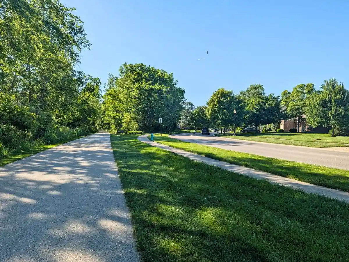
From the Town Hall rest area, the Rail Trail continues northwest from the Mile 1.5 post into a short wooded section. This segment is about 0.4 mile, with Town Hall at the south end and the Jennings Field parking lot on Bloor Lane at the north end.
Soon after leaving Town Hall, the trail enters a marked curve section with a centerline stripe. Riders should stay right through the bend and watch for people coming the other direction.
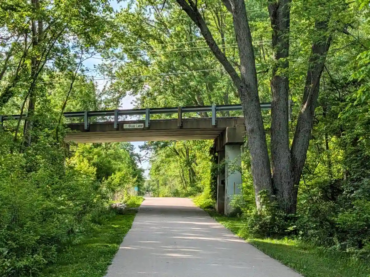
After the curve, the trail straightens toward Bloor Lane, with trees and low vegetation along both sides. Near the north end, the trail passes through the Bloor Lane underpass.
Just beyond the underpass, access paths leave the Rail Trail on both sides. The path on the right leads to the Jennings Field parking lot, while the path on the left leads to American Legion Trail Crossing, a memorial site honoring those who served in the U.S. Armed Forces. Its small parking area gives trail users another nearby parking option.
Section 2 at a Glance
| Detail | Information |
|---|---|
| Distance | ~0.4 mile |
| Parking | South end: Town Hall lot North end: Jennings Field lot on Bloor Lane |
| Street crossing | No |
| Restrooms | Town Hall: indoor restrooms available Monday–Friday, 8 AM–4 PM |
| Drinking water | Town Hall: indoor drinking fountains and bottle filler available Monday–Friday, 8 AM–4 PM |
| Bike repair station | Town Hall rest area |
| Marked curve | Centerline stripe through the curve shortly after Town Hall |
| Underpass | Bloor Lane underpass, just before the Jennings Field access path |
| Key points | Mile 1.5 post; Town Hall rest area; marked curve; Bloor Lane underpass; Jennings Field parking access |
3 of 5
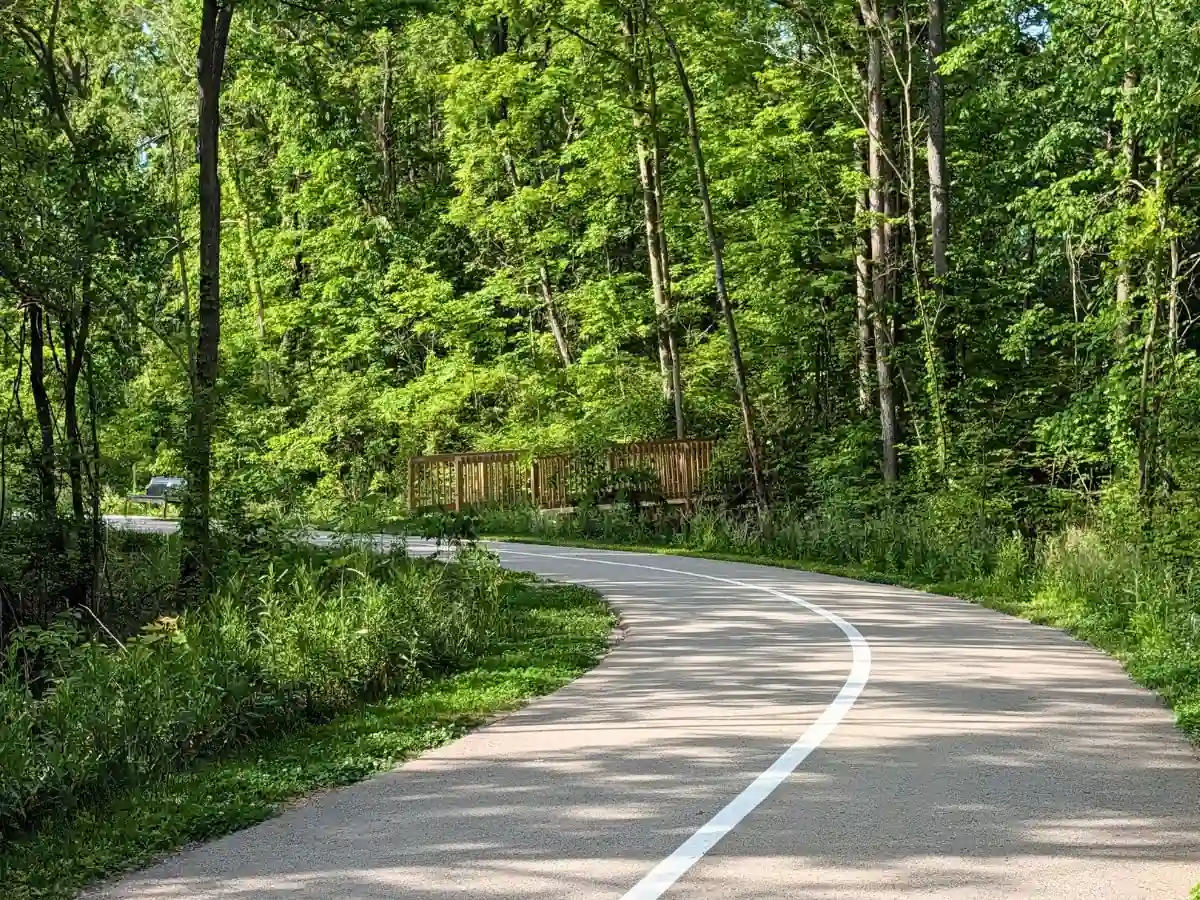
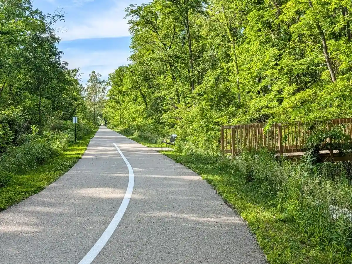
Section 3: Bloor Lane to Mulberry Street
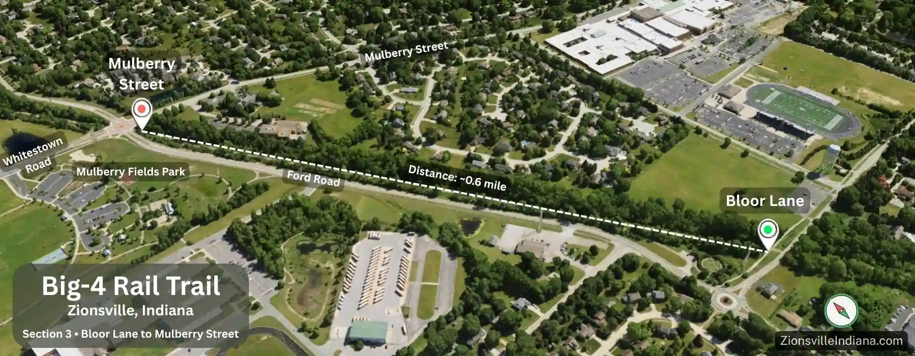
From the Jennings Field area near Bloor Lane, the Big-4 Rail Trail heads northwest toward Mulberry Street. This segment is about 0.6 mile and stays mostly wooded, with a long paved straightaway bordered by trees and tall grasses.
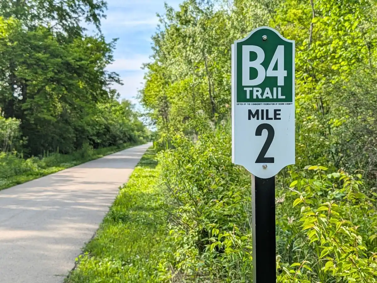
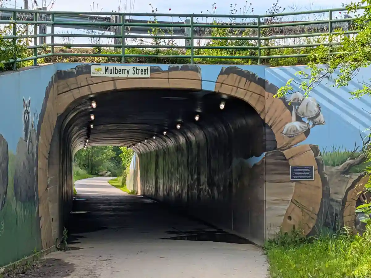
The Mile 2 post appears along this stretch before the route approaches the Mulberry Street tunnel. Just before the tunnel, a path on the right leads up to Mulberry Street, with nearby connections to neighborhood streets and local organizations.
After the tunnel, a path on the left climbs to Whitestown Road. Cross Whitestown Road at street level to reach Mulberry Fields Park, where restrooms, drinking fountains, a playground, and a paved park loop let walkers and runners extend the route before heading back to the Rail Trail.
Section 3 at a Glance
| Detail | Information |
|---|---|
| Distance | ~0.6 mile |
| Parking | South end: Jennings Field lot on Bloor Lane North end: Mulberry Fields Park lot; crossing Whitestown Road is required |
| Street crossing | No street crossing on the Rail Trail; Whitestown Road crossing required for Mulberry Fields Park access |
| Restrooms | Nearby at Mulberry Fields Park |
| Drinking water | Nearby at Mulberry Fields Park |
| Bike repair station | No |
| Tunnel | Mulberry Street tunnel |
| Key points | Mile 2 post; Mulberry Street access path before the tunnel; Mulberry Street tunnel; Whitestown Road access path after the tunnel; nearby access to Mulberry Fields Park |
4 of 5
Section 4: Mulberry Street to Heritage Trail Park
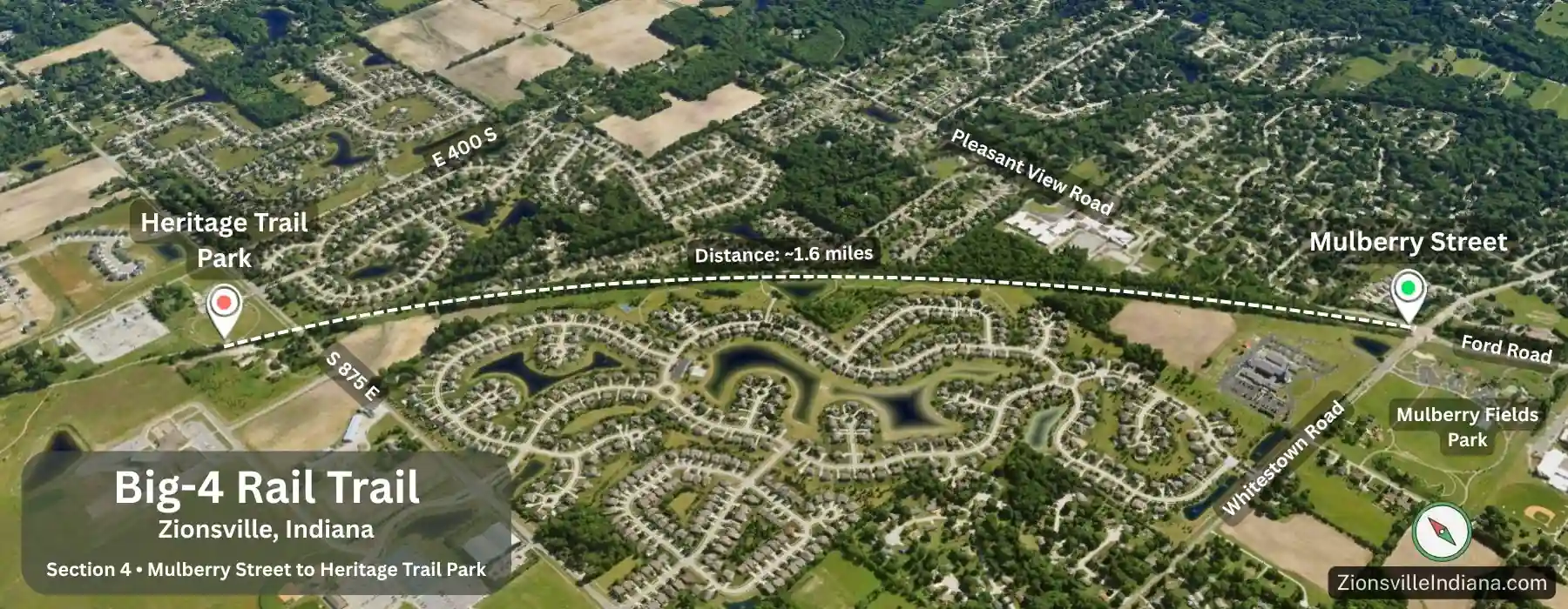
From Mulberry Street, the Big-4 Rail Trail continues northwest toward Heritage Trail Park. This is one of the longer Zionsville sections, about 1.6 miles, starting near the Mulberry Street tunnel and ending inside Heritage Trail Park.
The first portion stays wooded as the route moves away from Mulberry Street. About 0.8 mile in, an access path on the left leads to Carter Station park, a 20-acre wetland area next to the Rail Trail. The park has a short trail loop around a small pond, with a bench near the water among grasses, wetland plants, and trees. It is a quiet, tucked-away place to pause before returning to the Rail Trail.
Soon after the Carter Station access path, the surroundings shift to homes and neighborhood streets closer to the trail. Farther along, the route opens up again, with glimpses of houses set farther back as it approaches the utility corridor and S 875 E.
To reach Heritage Trail Park, cross S 875 E at the marked trail crossing and continue into the park. S 875 E can be busy, so slow down, use the crossing signal, and check both directions before entering the road.
Section 4 at a Glance
| Detail | Information |
|---|---|
| Distance | ~1.6 miles |
| Parking | South end: Mulberry Fields Park lot North end: Heritage Trail Park lot |
| Street crossing | S 875 E crossing near Heritage Trail Park; traffic can be busy |
| Restrooms | Mulberry Fields Park; Heritage Trail Park |
| Drinking water | Mulberry Fields Park; Heritage Trail Park |
| Bike repair station | No |
| Park connection | Carter Station Park access path about 0.8 mile from Mulberry Street |
| Tunnel | Mulberry Street at the south end |
| Key points | Carter Station Park access; residential stretch; open section near utility corridor; S 875 E crossing; Heritage Trail Park |
5 of 5
Section 5: Heritage Trail Park to Whitestown Border
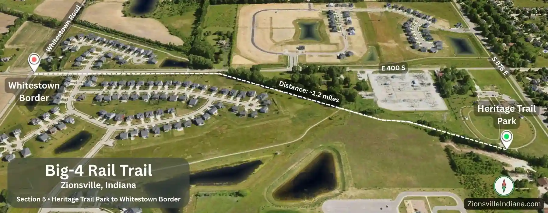
From Heritage Trail Park, the Big-4 Rail Trail heads northwest for about 1.2 miles to the Whitestown border. This final Zionsville stretch shifts away from the wooded sections farther south and into a broader edge-of-town corridor.
After leaving the park, the path has limited shade and wider views, with farm fields, utility infrastructure, and newer development nearby. There is more sky overhead here, with fewer trees close to the pavement as the route approaches 750 E.
At 750 E, the Zionsville portion ends at a signed road crossing beside open farmland. Across the road, the Big-4 Rail Trail continues into Whitestown, heading north before turning northeast toward Main Street in Downtown Whitestown. Main Street is about 1.5 miles beyond 750 E, with a crossing at Albert S. White Drive along the way.
At 750 E, the Zionsville portion ends at a signed road crossing beside open farmland. Across the road, the Big-4 Rail Trail continues into Whitestown, heading north before turning northeast toward Main Street in Downtown Whitestown. Main Street is about 1.5 miles beyond 750 E, with a crossing at Albert S. White Drive along the way.
The Whitestown trail continues beyond downtown to 500 E; together, the Zionsville and Whitestown sections make up nearly 9 miles of paved trail.
Section 5 at a Glance
| Detail | Information |
|---|---|
| Distance | ~1.2 miles |
| Parking | Heritage Trail Park lot |
| Zionsville endpoint | 750 E |
| Street crossing | None within the Zionsville portion; cross 750 E only to continue into Whitestown |
| Restrooms | Heritage Trail Park |
| Drinking water | Heritage Trail Park |
| Bike repair station | No |
| Shade | Limited |
| Trail character | Open edge-of-town stretch with farm fields and utility infrastructure nearby |
| Whitestown continuation | Main Street in Downtown Whitestown is about 1.5 miles beyond 750 E; the trail continues beyond downtown to 500 E |
| Key points | Heritage Trail Park; open corridor; 750 E endpoint |
Before you head out
The Big-4 Rail Trail follows a continuous paved path from the Zionsville Road Trailhead past Town Hall, Mulberry Fields, and Heritage Trail Park. Along the way, the scenery shifts from creek crossings and wooded stretches to park access points, neighborhood edges, and open farmland near 750 E. Use the section tables to pick a starting point, check restroom and water access, and decide where to turn around — or continue into Whitestown.
Last updated: June 14, 2026